Scanner LiDAR Raven
Your Entry into SLAM.
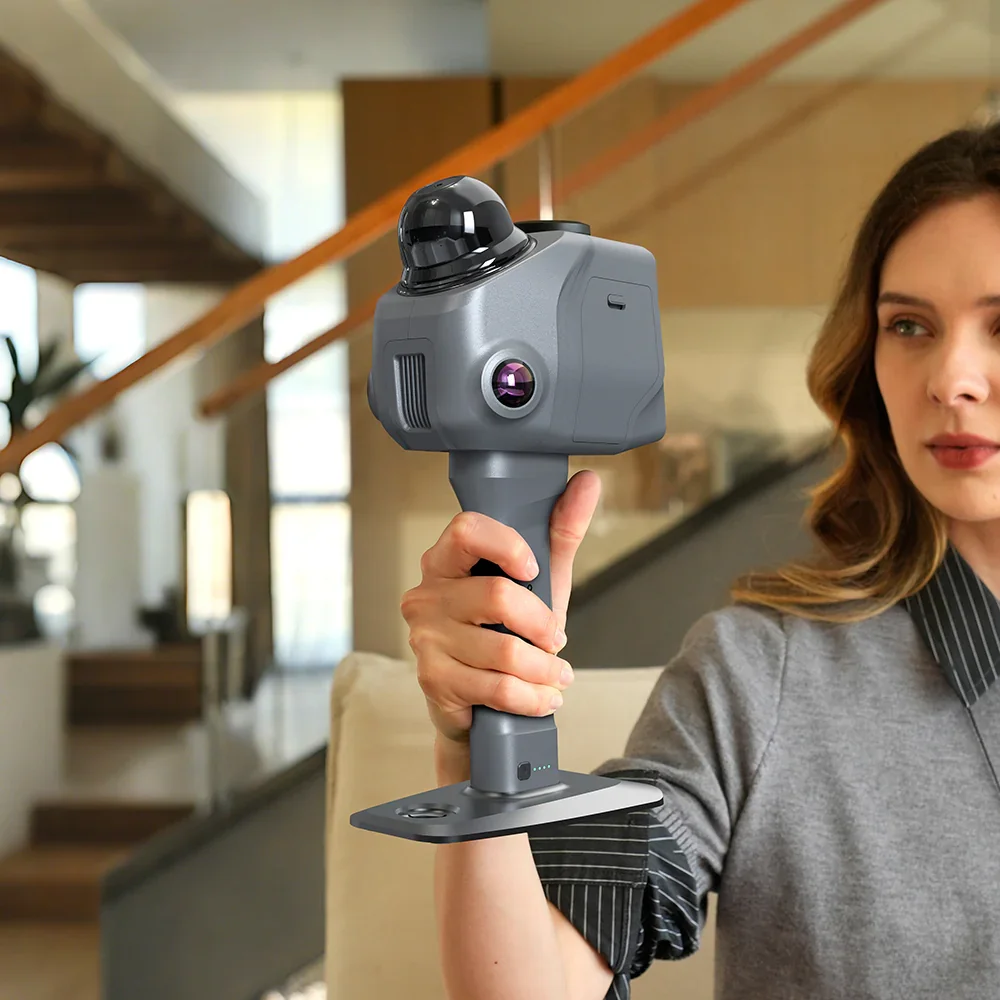
Portable SLAM LiDAR scanner for as-built capture, site documentation and digital twins. Combines LiDAR and IMU fusion with real-time RGB acquisition and optional RTK georeferencing.
The SLAM Scanner for the Job Site
Portable, autonomous and cable-free: Raven lets you capture site progress, manage construction levels and measure everything in real time. Works in any light condition, turning surveying into a fast, continuous and error-free process.
Enhanced SLAM Technology
LiDAR + IMU + GPS combined for stable acquisition even while moving, in complex interiors or without GPS signal.
4K Photorealistic Reconstruction
RGB point clouds and Gaussian Splatting with natural colours, perfect for digital twins, virtual tours and documentation.
Hot-Swap Batteries · 2h Scan
12,000 mAh quick-release handles. Replace in seconds, no interruptions on long job sites.
3.9" AMOLED Display
Real-time point cloud monitoring, scan settings management and rapid survey progress review on-device.
Raven + Analist 2027: The Complete Professional Workflow
Raven captures the point cloud. Analist 2027 transforms it into a deliverable. The complete hardware + software pipeline, with support included.
Total Point Cloud Management
Analist 2027 imports Raven output (PLY, LAS, E57, OBJ, XYZ) directly into the working environment for section and elevation extraction, no intermediate exports, no data loss.
3D Models and Terrain Analysis
From point cloud to executive project in a single flow. Automatic DTM/DSM generation, contour lines, profiles, volume calculations for cut and fill.
RayStudio Processing Suite
Included with Raven: dedicated processing software for rapid point cloud preparation before import into Analist. AI-based one-click denoising, multi-format export, advanced visualisation tools.
From Field to Deliverable, In Three Steps
Walk the site with Raven. 150,000 points per second, in any light condition, indoors or outdoors, no GPS required.
Clean and refine the point cloud with RayStudio. AI denoising in one click. Export to PLY, LAS, E57 or import directly into Analist 2027.
Generate terrain models, extract architectural sections, calculate volumes and export DWG, IFC or Gaussian Splatting outputs.
Choose Your Configuration
Raven Standard
Entry-level SLAM for as-built and interior surveys.
- Single camera · 12 MP Sony fisheye
- Full field of view: 360°
- Ideal for interiors, architecture and documentation
Raven Max
Dual camera for superior colour quality.
- Dual camera for enhanced texture coverage
- 4K Gaussian Splatting RGB
- Wider visual coverage for complex environments
Raven Max RTK
Centimetric georeferencing for topographic workflows.
- All Max features plus integrated RTK GNSS module
- Centimetric accuracy with base station
- Ideal for georeferenced surveys and terrain modelling