Analist 2027
From Field to BIM. One Software, Every Survey.
Software powered with Autodesk Technology for topographic survey, architectural survey, terrain modelling and design.
A Single Working Environment
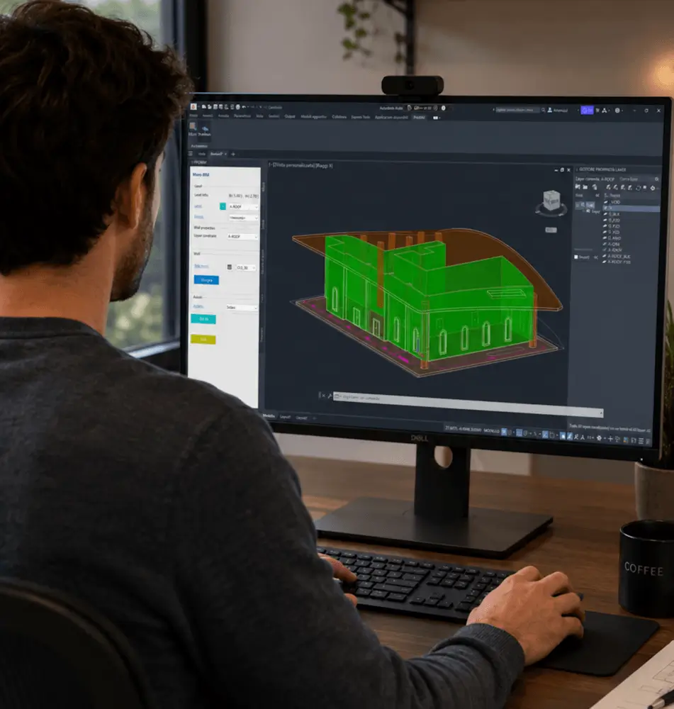
Analist 2027 is the complete software for surveyors, engineers, architects, geomatics professionals, and land technicians. Designed to simplify and enhance every phase of surveying, from data collection to graphical output.
- Architectural BIM modelling
- Survey-to-CAD workflows
- Point cloud classification
- Integrated topographic design
One Platform, Every Survey Type
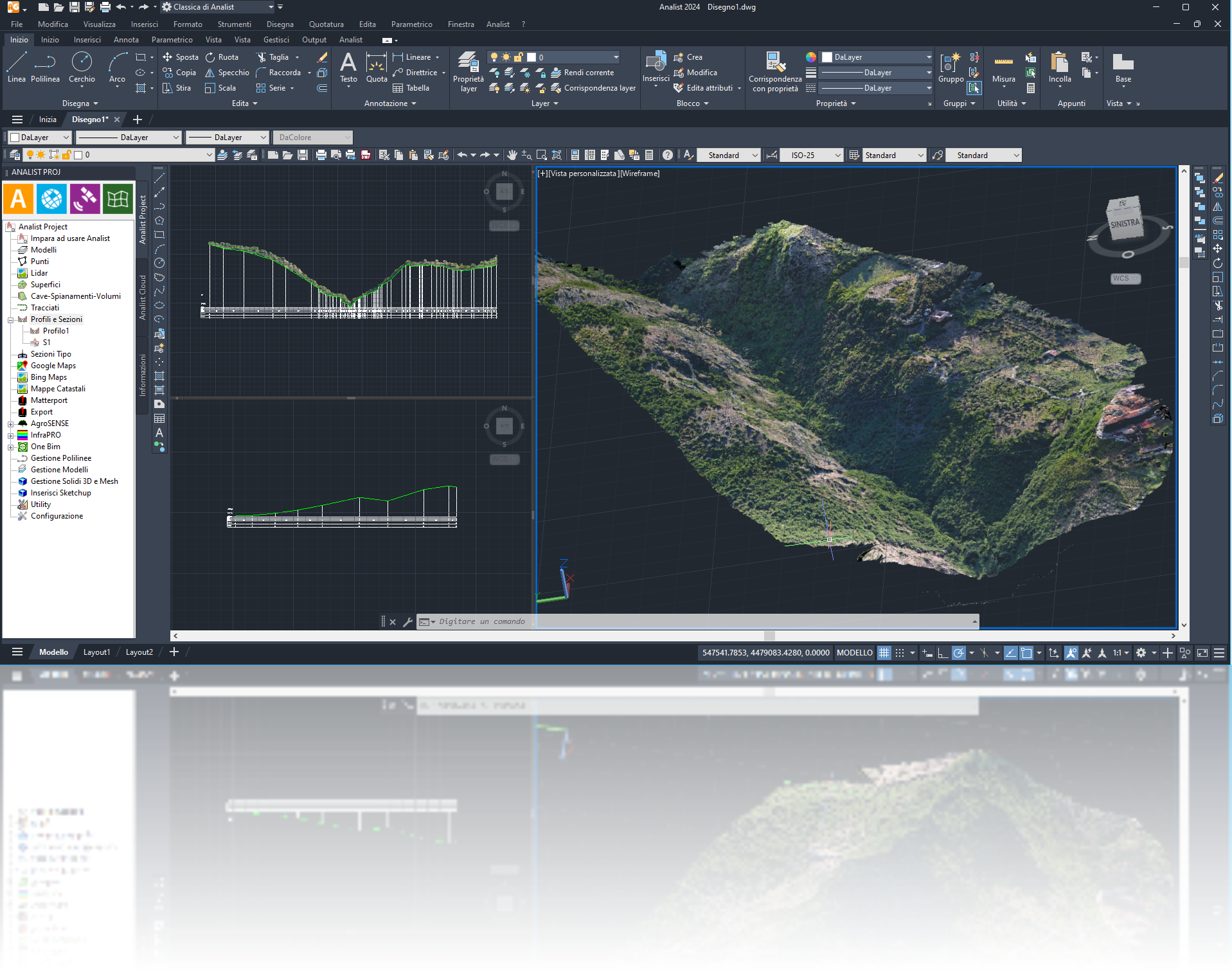
Topographic Survey
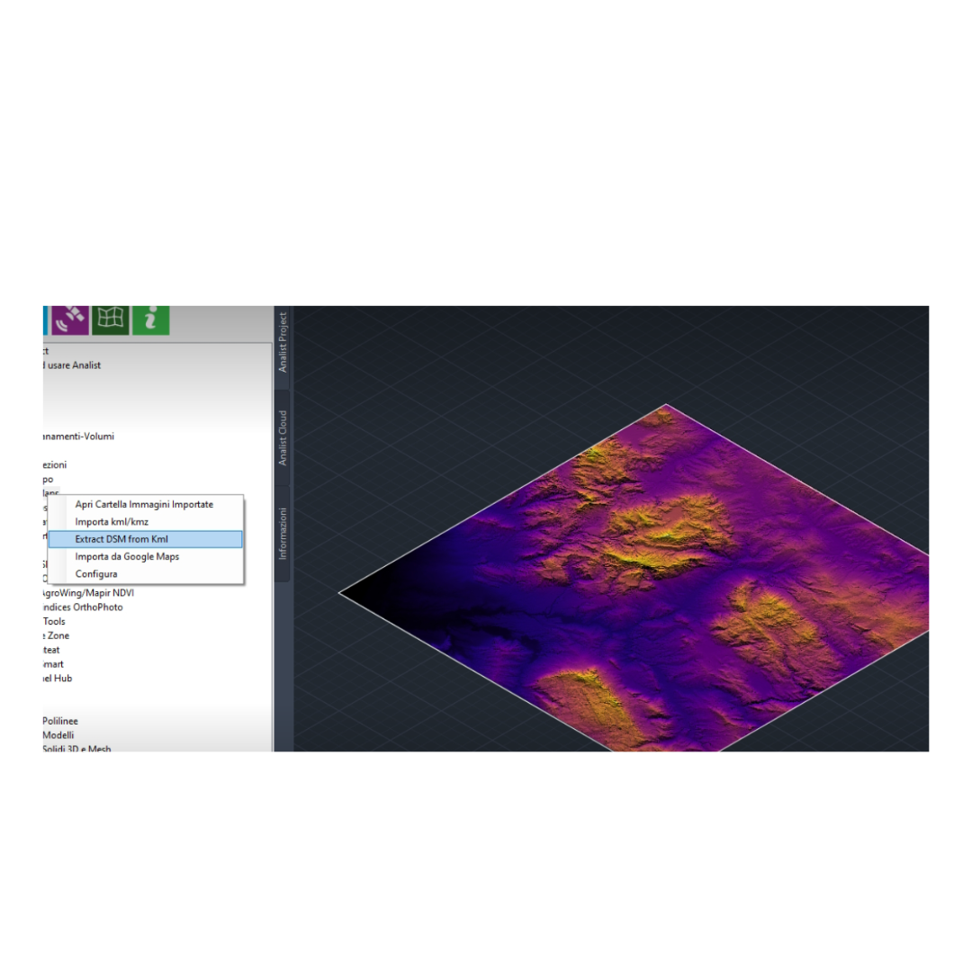
The complete solution for terrain modelling and design. 3D terrain models from drone, GPS and total station data; profiles, sections and contour lines; volume calculations (cut/fill, leveling, earthworks); DTM/DSM import from Google Maps, Bing Maps, TinItaly; integration with E57 point clouds.
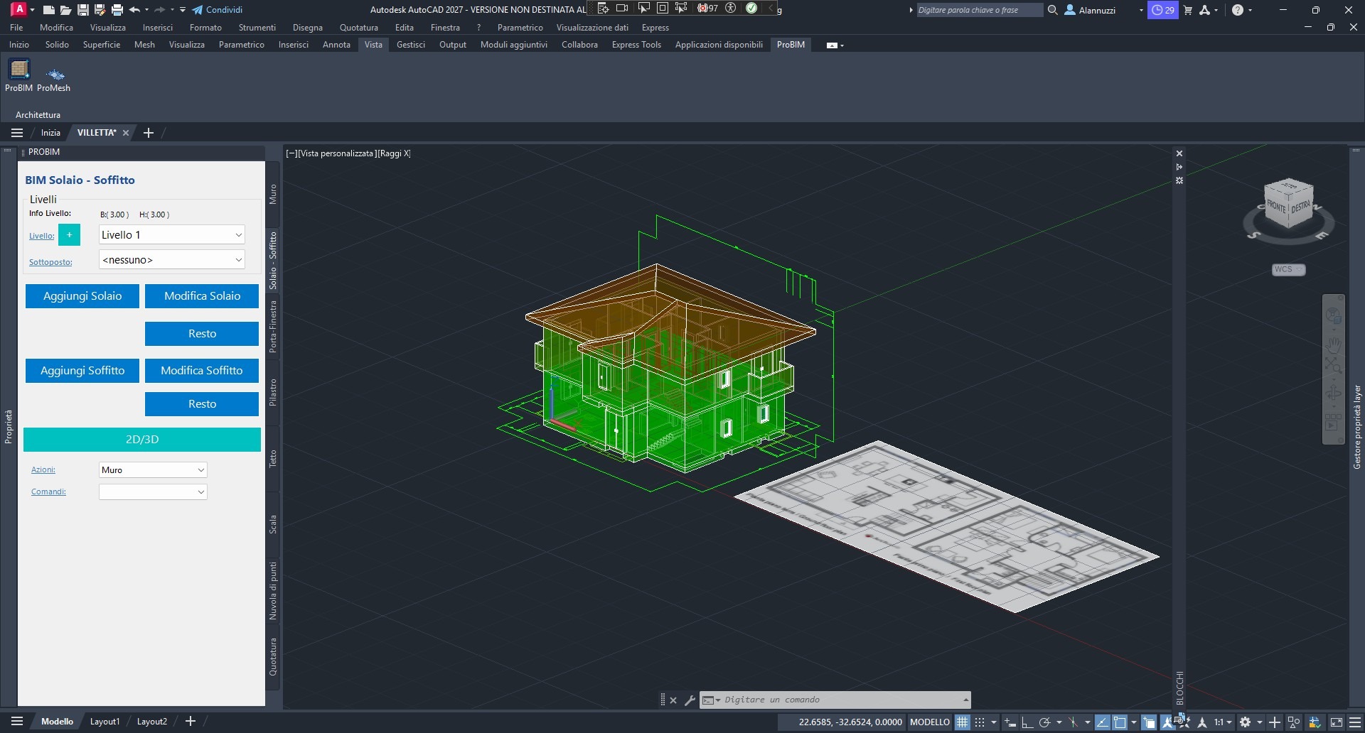
Architectural Survey
Extract drawings directly from point clouds. Plans, elevations and sections from 3D point clouds; automatic perspective correction of facade images; Matterport .svg to .dwg conversion; high-precision architectural sections and orthographic views.
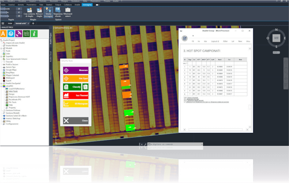
Thermographic Inspections
Professional analysis compliant with IEC TS 62446. Real-time hotspot detection on solar panels, thermal orthophoto upload from drone or manual inspection, georeferenced reports with charts and thermal maps, predictive maintenance for PV systems and industrial roofs.
Terrain & Design
Advanced tools for infrastructure and civil works. Longitudinal profiles and cross-sections, volume calculation between surfaces over time, basin and stepped surface creation, track management and design on sections.
From Acquisition to Deliverable — One Integrated Flow
Import data from GPS ProTRACK, total stations, drones, laser scanners and Matterport. All sources, one environment.
Generate terrain models, extract point cloud drawings, run volume calculations and thermographic analysis.
Export to DWG, IFC, DXF. Share via Analist CLOUD. Deliver BIM models, technical reports and digital twins.
Extend Analist with Specialist Modules
Analist InfraPRO
Thermographic analysis module for PV systems and industrial inspections. Compliant with IEC TS 62446.
Analist Matterport
Convert Matterport floor plans from .svg to .dwg in one click.
Analist Photo
Automatic perspective correction of images captured with smartphone, drone or camera.
Analist TakeOff
Quantity takeoffs from DWG or PDF drawings. From survey to job accounting.
Analist Framer
Design curtain wall elevations with modular schemes, profiles and hatches.
Analist AGRO
Precision agriculture module. NDVI maps from multispectral drone data for crop monitoring.
Technical Specifications
The Software Built for Every Survey.
Join 200,000+ professionals across Europe who rely on Analist every day.
Request Info